
Useful Google Maps Tricks Most People Miss
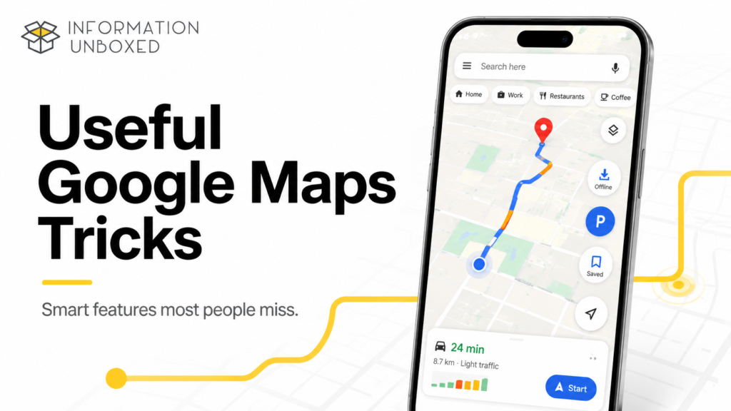
Useful Google Maps tricks can make your daily travel easier, faster, safer, and much more organized. Most people use Google Maps only for basic directions, but the app can do a lot more than just show routes.
You can download maps for offline use, save your parking location, share your live location, check traffic before leaving, create travel lists, avoid tolls, measure distance, remember places from screenshots, and even use newer AI-powered features in supported regions.
Google Maps includes live traffic data, real-time GPS navigation, public transport directions, walking routes, cycling routes, and information about millions of businesses and places. Google’s Play Store listing says Maps helps users navigate with live traffic and GPS guidance, and discover more than 250 million businesses and places with reviews, photos, and helpful information.
In this guide, we will cover the best useful Google Maps tricks most people miss and explain how to use them on Android and iPhone.
Why You Should Know These Google Maps Tricks
Google Maps is not just a navigation app anymore. It is also a travel planner, local discovery tool, traffic checker, offline map, parking assistant, safety tool, and productivity app.
These tricks can help you:
- Travel without internet using offline maps
- Avoid traffic, tolls, and route confusion
- Save places you want to visit later
- Share live location with family
- Remember where you parked
- Plan trips better
- Check if a place is crowded
- Find nearby fuel, food, ATMs, hotels, and washrooms
- Improve privacy and location control
The best part is that most of these features are already inside Google Maps. You just need to know where to find them.
1. Download Offline Maps Before You Travel
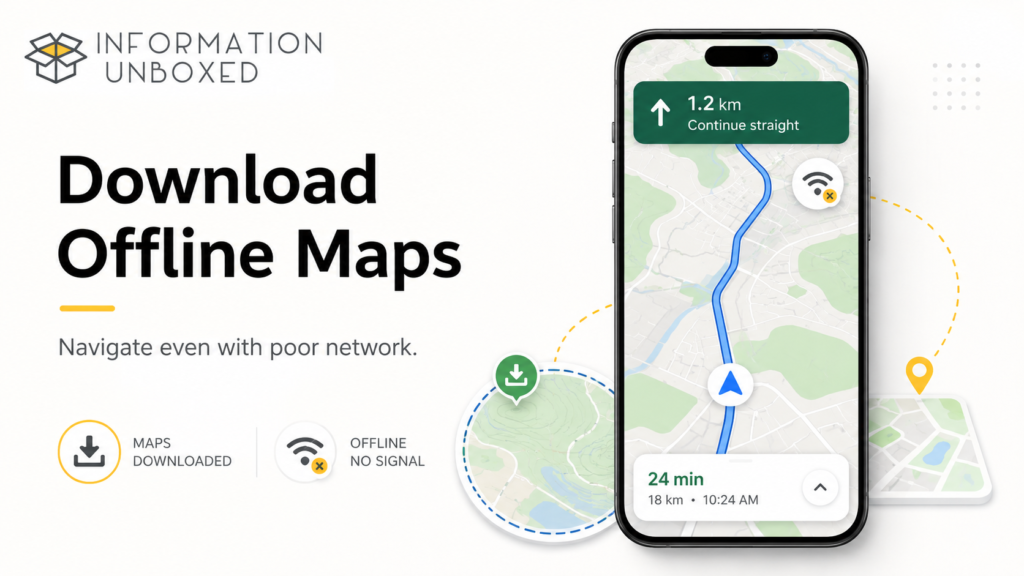
One of the most useful Google Maps tricks is downloading offline maps. This is helpful when you travel to a new city, hill station, international destination, or low-network area.
Offline maps let you navigate even when mobile data is weak or unavailable.
You can read Google’s official Offline Maps guide for more details:
https://support.google.com/maps/answer/6291838
Google’s official help page says you can open Google Maps, tap your profile picture, go to Offline maps, and select your own map to download. You can also update, rename, or delete offline maps later.
How to Download Offline Maps
- Open Google Maps.
- Tap your profile picture.
- Tap Offline maps.
- Select Select your own map.
- Adjust the area.
- Tap Download.
Best Time to Use This Trick
Use offline maps before:
- Road trips
- International travel
- Hill station trips
- Village or remote area travel
- Places with poor network
- Long highway drives
Pro Tip: Download maps on Wi-Fi before leaving home to save mobile data.
2. Save Your Parking Location
If you often forget where you parked your car or two-wheeler in malls, airports, hospitals, events, or busy markets, this trick is very useful.
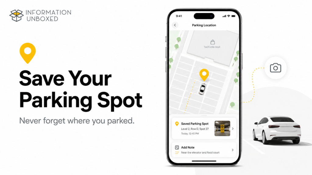
Google Maps lets you save your parking location by tapping the blue dot that shows your current location and selecting Save your parking. Google also says users can add notes or photos, such as parking floor or time left, and even share the parking location with others.
How to Save Parking Location
- Open Google Maps after parking.
- Tap the blue location dot.
- Tap Save your parking.
- Add notes or photos if needed.
Where This Helps
- Shopping malls
- Airports
- Large parking lots
- Concerts and events
- Hospitals
- Office basements
- Tourist spots
This is one of those small Google Maps features that can save you a lot of frustration.
3. Add Multiple Stops to Your Route
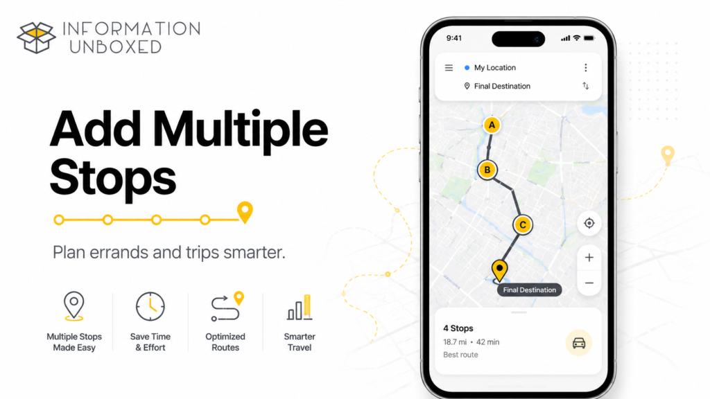
Most people search one destination at a time, but Google Maps lets you add multiple stops in one trip. This is perfect when you want to pick up someone, stop for fuel, visit a store, and then reach your final destination.
Google’s official Maps tips explain that after searching for your first destination, you can tap Directions, open the three-dot menu, choose Add stop, and add another destination.
How to Add Multiple Stops
- Search your final destination.
- Tap Directions.
- Tap the three-dot menu.
- Tap Add stop.
- Add another place.
- Drag stops to reorder them.
Best Uses
- Road trips
- Office commute with pickups
- Grocery + fuel + home route
- Delivery planning
- Family outings
- Travel itineraries
This makes Google Maps work like a mini route planner.
4. Share Your Live Location with Family
Live location sharing is very useful when you are traveling alone, taking a cab, going to a new place, or meeting someone.
You can share your real-time location for a selected time with trusted contacts. This can help family members track your journey and know when you are arriving.
How to Share Live Location
- Open Google Maps.
- Tap your profile picture.
- Tap Location sharing.
- Tap Share location.
- Choose time duration.
- Select contact or sharing app.
When to Use This
- Cab rides
- Solo travel
- Late-night travel
- Airport pickups
- Meeting friends
- Road trips
Safety Tip: Share location only with people you trust. Stop sharing when it is no longer needed.
5. Check Traffic Before Leaving
Google Maps can show live traffic conditions so you can avoid heavy congestion. Instead of opening Maps only after you start driving, check traffic before leaving.
How to Check Traffic
- Open Google Maps.
- Search your destination.
- Tap Directions.
- Check route colors.
Usually:
- Blue means clear route
- Orange means moderate traffic
- Red means heavy traffic
Why This Helps
Checking traffic before leaving can help you:
- Leave earlier
- Choose a better route
- Avoid traffic-heavy areas
- Plan airport travel better
- Avoid office rush timing
For daily commuters, this is one of the simplest Google Maps habits to build.
6. Avoid Tolls, Highways, or Ferries
Sometimes the fastest route is not the route you want. You may want to avoid tolls, highways, or ferries depending on your budget, road preference, or vehicle type.
How to Avoid Tolls or Highways
- Search your destination.
- Tap Directions.
- Tap the three-dot menu.
- Tap Route options.
- Select Avoid tolls, Avoid highways, or Avoid ferries.
Best Use Cases
- Saving toll money
- Avoiding highways at night
- Two-wheeler route planning
- Scenic road trips
- Local route preference
This is especially useful in India where toll costs and route conditions can vary a lot.
7. Use Google Maps Timeline to Remember Past Trips
Google Maps Timeline can help you remember places you visited and routes you took, if Timeline is turned on. Google says Timeline helps users go back in time and remember where they have been by automatically saving visits and routes on signed-in devices. You can also edit or delete Timeline data.
How to Check Timeline
- Open Google Maps.
- Tap your profile picture.
- Tap Your Timeline.
- Choose date, place, city, or trip.
Why Timeline Is Useful
Timeline can help you remember:
- A restaurant you visited
- A shop location
- Travel route
- Old trip details
- Places from vacation
- Date of a visit
Privacy Note
Timeline is personal and should be used carefully. Google explains that Timeline is off by default, and if turned on, precise device location may be saved regularly for eligible signed-in devices.
If privacy matters to you, review Timeline settings and delete old data when needed.
8. Save Favorite Places into Lists
Google Maps lets you save places into lists like Favorites, Want to go, Starred places, or custom lists. This is extremely useful for trip planning and city exploration.
How to Save a Place
- Search for a place.
- Tap the place name.
- Tap Save.
- Choose a list or create a new one.
List Ideas
You can create lists like:
- Hyderabad cafes to try
- Family restaurants
- Weekend places
- Tokyo trip plan
- Kids-friendly places
- Shopping spots
- Best street food
- Doctor/hospital list
This makes Google Maps feel like a personal travel notebook.
9. Label Home, Work, School, or Important Places
Labeling places saves time because you do not need to type full addresses repeatedly.
How to Label a Place
- Search the address.
- Tap the place details.
- Tap Label.
- Add a name like Home, Work, School, Gym, or Doctor.
Best Places to Label
- Home
- Office
- Child’s school
- Gym
- Doctor clinic
- Parents’ home
- Frequent pickup points
- Favorite supermarket
Once saved, you can simply search “Home” or “Work” to start navigation quickly.
10. Measure Distance Between Two Points
Google Maps can measure straight-line distance between two or more points. This is useful for checking land distance, walking distance, property distance, or approximate distance across a park or area.
How to Measure Distance
- Open Google Maps.
- Long-press a point on the map.
- Tap the place card.
- Choose Measure distance.
- Move the map and add more points.
Where This Helps
- Property checking
- Walking routes
- Running routes
- Park distance
- Travel planning
- Estimating area distance
This is a hidden feature many casual users miss.
11. Use Street View or Live View Where Available
Street View helps you see real-world visuals of streets, buildings, and nearby landmarks before you visit a place. Live View can help with walking directions in supported areas by using your phone camera and AR-style guidance.
Best Uses
- Finding shop entrances
- Checking building surroundings
- Exploring hotels before booking
- Understanding walking directions
- Avoiding confusion in crowded areas
- Finding landmarks before arrival
This is especially useful in unfamiliar cities.
12. Check Popular Times Before Visiting
Google Maps shows popular times for many places, which can help you avoid crowds.
How to Check Popular Times
- Search the place.
- Scroll down in the place details.
- Look for Popular times.
Where This Helps
- Restaurants
- Cafes
- Malls
- Tourist places
- Hospitals
- Banks
- Government offices
- Salons
If you hate waiting, check popular times before leaving.
13. Find Nearby Essentials Quickly
Google Maps is great for finding nearby essentials, but most people do not use it smartly.
Search phrases like:
- Petrol pump near me
- Pharmacy near me
- EV charging near me
- ATM near me
- Hospital near me
- Grocery near me
- Restaurants open now
- Cafes with good ratings
- Vegetarian restaurants near me
Pro Tip
Use filters like:
- Open now
- Top rated
- Distance
- Price
- Rating
- Cuisine
This helps you avoid wasting time on closed or poorly rated places.
14. Find Wheelchair Accessible Places and Routes
Google Maps includes accessibility-related features for users who need wheelchair-friendly routes or places. Google’s accessibility help page says users can adjust accessibility settings and use features to find wheelchair-accessible transit and places.
Google has also explained that users can find wheelchair-accessible transit routes by choosing public transport directions, tapping Options, and selecting wheelchair-accessible route options where available.
Why This Feature Matters
It can help people find:
- Wheelchair-accessible entrances
- Accessible public transport routes
- More comfortable travel options
- Easier route planning for elderly family members
- Better accessibility information before visiting
This is a genuinely important feature many people do not know about.
15. Use Google Maps to Plan a Trip
Google Maps can be used as a simple travel planner. You can search places, save them into a list, check distance between them, add multiple stops, download offline maps, and share your saved list with travel partners.
Simple Trip Planning Method
- Search the destination city.
- Save restaurants, attractions, hotels, and shopping areas.
- Create a custom list.
- Add multiple stops for each day.
- Download offline maps.
- Share the list with family or friends.
Example
For a 3-day trip, create lists like:
- Day 1 places
- Day 2 places
- Food spots
- Shopping places
- Emergency locations
- Kids-friendly places
This makes your travel more organized and less stressful.
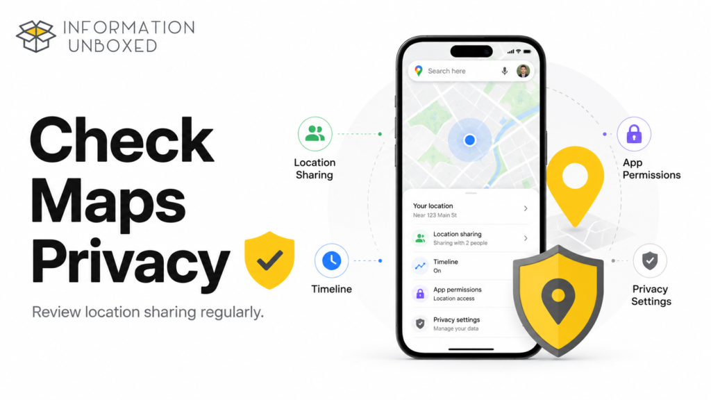
Bonus: Google Maps Privacy Settings You Should Check
Since Google Maps uses location data, it is important to review privacy settings.
Check these:
- Location permission for Google Maps
- Timeline settings
- Location sharing
- Saved places visibility
- Google account security
- App permissions
You can pause or delete Timeline data if you do not want Maps to store your location history. Google says users can edit or delete Timeline data at any time.
For better phone privacy, also read our guide on how to check if your phone is being tracked.
Quick Summary: Best Google Maps Tricks
| No. | Google Maps Trick | Best For |
|---|
| 1 | Download offline maps | Low network travel |
| 2 | Save parking location | Malls, airports, events |
| 3 | Add multiple stops | Road trips and errands |
| 4 | Share live location | Safety and coordination |
| 5 | Check traffic before leaving | Daily commute |
| 6 | Avoid tolls/highways | Route control |
| 7 | Use Timeline | Remember past trips |
| 8 | Save places into lists | Travel planning |
| 9 | Label places | Quick navigation |
| 10 | Measure distance | Planning and checking distance |
| 11 | Use Street View/Live View | Finding entrances |
| 12 | Check popular times | Avoiding crowds |
| 13 | Find nearby essentials | Quick local search |
| 14 | Find accessible routes | Inclusive travel |
| 15 | Plan trips with saved lists | Organized travel |
Final Thoughts
These useful Google Maps tricks can make your daily travel and trip planning much easier. Most people only use Maps for directions, but features like offline maps, parking location, multiple stops, live location sharing, Timeline, saved lists, traffic checks, popular times, and accessibility options can save time and reduce stress.
Start with the tricks you will actually use every week: download offline maps, save parking, check traffic, share live location when needed, and save favorite places into lists.
Google Maps is already on most phones. Using it smarter can make your everyday travel safer, faster, and more organized.
FAQs
1. What are the most useful Google Maps tricks?
Some of the most useful Google Maps tricks include offline maps, saving parking location, adding multiple stops, sharing live location, checking traffic, using Timeline, saving places, and avoiding tolls.
2. Can Google Maps work without internet?
Yes, Google Maps can work offline if you download the map area in advance. Offline maps are useful in low-network areas, but some live features like real-time traffic may need internet.
3. How do I save my parking location in Google Maps?
Tap the blue dot that shows your current location and select Save your parking. You can also add notes or photos to remember details like parking floor.
4. Can I add multiple stops in Google Maps?
Yes, after selecting directions, open the three-dot menu and choose Add stop. You can add and reorder stops before starting navigation.
5. Is Google Maps Timeline private?
Google Maps Timeline is personal to your account, but you should still review privacy settings. Google says Timeline can be edited or deleted at any time.
6. Can Google Maps help avoid crowded places?
Yes, many places show popular times, which can help you choose less crowded hours before visiting.
7. Can Google Maps show wheelchair-accessible routes?
Google Maps has accessibility options for wheelchair-accessible routes and places where available.



Leave a Reply
Want to join the discussion?Feel free to contribute!